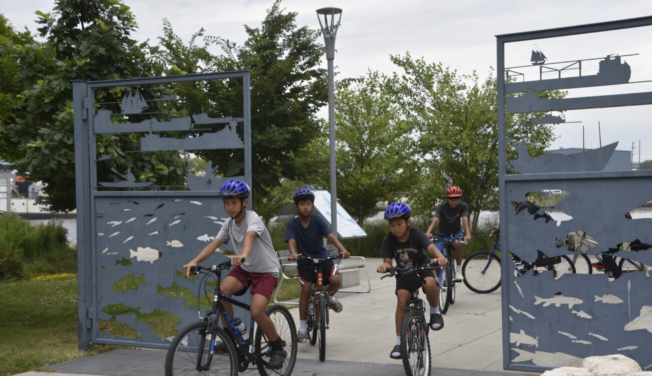
The Milwaukee Loop
Connecting People, Building Community
The Route of the Badger (ROTB) is an effort of Bike Fed, the Southeastern Wisconsin Regional Planning Commission (SEWRPC), and Rails to Trails Conservancy (RTC) to connect the seven southeast counties in WI to create a 705-mile connected trail network. Within this network, some trails have emerged as natural loops connecting and creating opportunities for communities to come together and reach neighborhoods that have not been connected by trail before.
The Milwaukee Loop is just one of these examples through the ROTB network. Progress toward its development has shown significant advancements over the past few years and is worth sharing with all of you.
The Milwaukee Loop will include the Hank Aaron State Trail, the Oak Leaf Trail, and the Beerline Trail as well as the future 30th Street Corridor Trail. Altogether the connected trails will total over 18 miles with 90% on trail and the other 10% on-street (with half of the on-street mileage benefitting from protected bike lanes).
Progress toward completion of the Loop is ongoing and could be summarized as slow, steady, and purposeful. The Hank Aaron State and Oak Leaf Trails are finished, and a good chunk of the Beerline Trail is completed as well.
We are excited to share that by the end on next summer, final engineering will be completed for the Beerline north and northwest extension. Starting at the Capitol Drive Bridge to Port Washington Road the on-street connection will head north to Home Depot and then veer directly west and proceed under I-43.
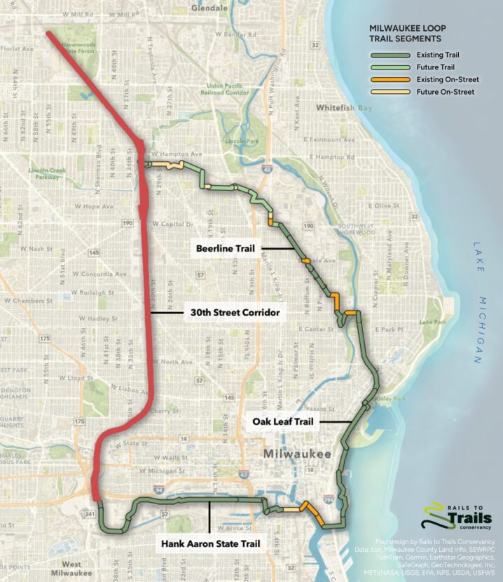
When our friends at WisDOT rebuilt the 60-year-old interstate they included a $4 million dollar tunnel addition to continue a straight connection with the Beerline Trail. We were fortunate that the private landowner who owns the land to the east and west of the interstate provided an easement to the City of Glendale and to the City of Milwaukee to build the Beerline extension over their land. Without this willingness, generosity, and easement arrangement, the direct route of the Beerline would not be a possibility.
The trail will then cross Green Bay Ave and continue along a city owned parcel of land just south of W. Cornell Street. From here, the trail will provide two options. The first will run directly into the 20th Street Corridor (which runs north under the WE Energies power lines) and will continue all the way to Meaux Park. The second will continue the Beerline Trails northwest trajectory all the way to 24th Place. From here, riders will have about a one-half mile on-street connection to pick up the 30th Street Corridor.
Is the 30th Street Corridor Trail a trail yet? This fall a $700,000 WisDOT/ SEWRPC/ Milwaukee County Parks Preliminary Feasibility Study will be conducted which will result in 30% plan designs for the trail. The Feasibility Study will identify ramp locations, railroad/trail pinch points, bridge options, and street crossings; it will identify costs and provide so much more information. The concept of a 30th Street Corridor Trail has never received this level of funding and engineering before, and we are thankful to all the partners who have helped to get us to this point.
The Milwaukee Loop might have seemed like a dream even just 2 years ago, but now with the current investments in the Beerline Trail and the future 30th Street Corridor Trail, that dream is beginning to come true.
This article was first featured in the Bike Fed’s 2025 Ride Guide magazine.