Biking the Ice Age Trail
Wisconsin’s Ice Age Trail (IAT) is a stunning 1,200-mile-long National scenic hiking trail. It winds across the state from St. Croix Falls in the northwest, then east and south to Janesville, finally north again ending in Door County. Most of the route is in “the woods,” but I’d like to draw your attention to the “Baraboo Loop,” a 224-mile loop of connecting roads north and east of Baraboo. My friend Brian and I have been segment-hiking and bikepacking for about ten years. We weren’t looking forward to hiking this loop, but then we realized we could bike the route in just a few days.
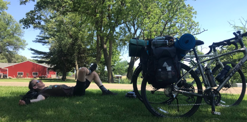
A June bikepacking trip in Wisconsin is a joy to plan and easy to undertake. It’s a great outdoor activity. Start with a set of Wisconsin Bike Fed route planning maps that identify low-volume and wide-shoulder routes then explore the web for camping sites. Brian and I are partial to camping in our State Parks; they are wonderful and scattered throughout the state. In no time at all, you can assemble a multi-day route with rest stops, campsites, and off-the-beaten-path towns for grub. Make the route what you want it to be, biking as many miles per day as you feel comfortable. Set up your bike with good lights, a bike rack (and some bungee cords to hold things onto the rack), tires to match your planned terrain, and panniers. Plan to carry everything you need for riding and camping: tent, sleeping bag, camp chair, snacks, bike repair kit, flashlights, cook kit, and clothing.
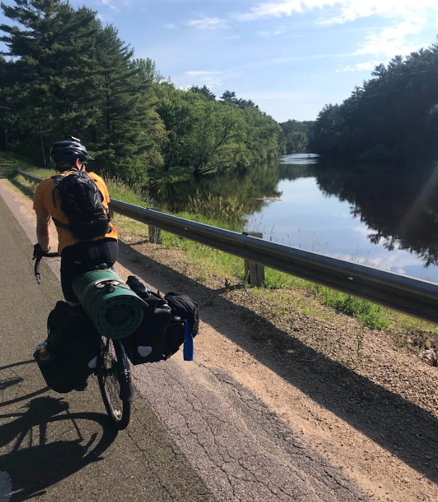
We planned three days of biking (day one: 83 miles; day two: 77 miles; day three: 64 miles) with overnight camping at Mirror Lake State Park (south of Wisconsin Dells) and Roche-A-Cri State Park (just outside of Adams/Friendship). The route included Devil’s Lake State Park and much of central Wisconsin, so there was always somewhere to rest or refuel. We started the trip “between the rivers” in Portage at Riverside Park. Biking south and east, we meandered along the Wisconsin River on the earthen levee of the river’s left bank. From the Levee Trail, we continued east into Wyocena.
Highway 22 south from Wyocena was the hilliest part of the whole trip but we were in Poynette just eleven miles later. A perfectly-graded Baraboo quartzite trail took us downhill towards Highway 51. The last half mile of Pine Hollow Road paralleled the highway closely – reminding us of the wonderful difference between seeing the world from a bike seat versus a car. The f ive miles into Lodi were picturesque. Tiny farms and pasture on the right; rocky heights and forest on the left. Temperatures were cool as the sun was still behind the natural elevation of the terrain to the south. The Merrimac Ferry was our halfway point for the first day.
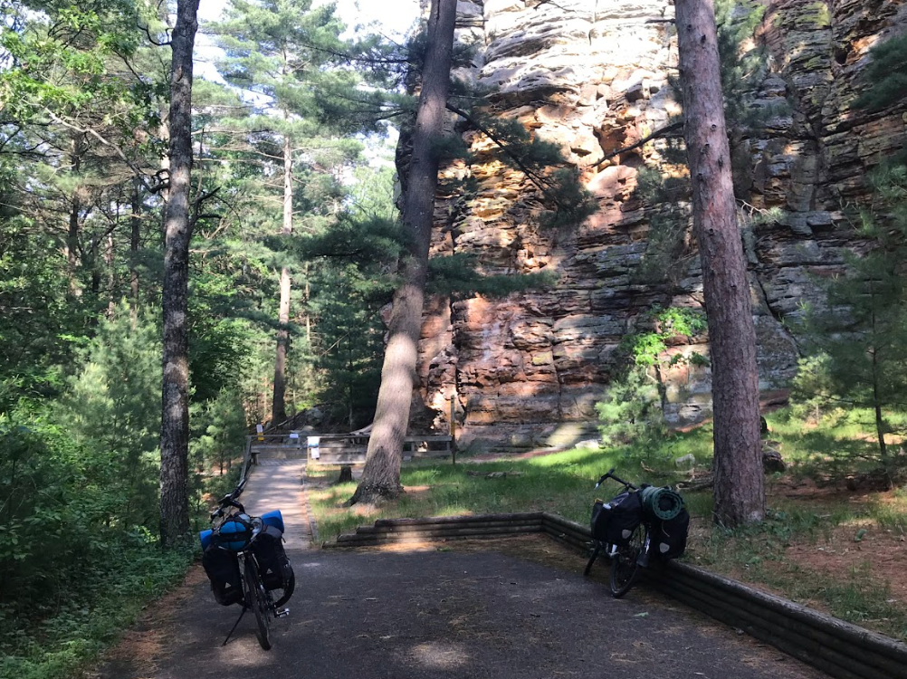
We enjoyed lunch in the shade while the ferry slowly churned its way back to the southern shore. The ferry provides a peaceful seven-minute trip across the hard-working Wisconsin River. From Merrimac, we biked north and west towards the western gateway to Devil’s Lake State Park. The climb up to the park was long and slow, but quiet and shady. We rested in the shade of one of the park’s many pavilions as the sun intensified. If any part of Wisconsin epitomizes our glacial past, it’s Devil’s Lake State Park. It is Wisconsin’s National Park.
After our respite, we exited the park and headed towards the Baraboo North Range. I left my Camelback at the park pavilion and had to double back to get it (Ugh!). The Baraboo Range is like a pivot point of the Ice Age in Wisconsin. The eastern ends of the range were glaciated while the western portions were not and became part of Wisconsin’s “driftless” region.
We headed toward Lake Delton on County Road A. In 2008, heavy rain and flooding breached a few hundred yards of roadway between Lake Delton and the Wisconsin River, wiping out this stretch of road. Fortunately, no physical evidence of that catastrophic event still exists. We then backtracked south through chaotic downtown Lake Delton and towards Mirror Lake State Park. Brian suggested dinner at the Ishnala Supper Club, and although we had to wait outside over an hour for a table, it gave us ample time to reflect on a fantastic first day.
The next morning, we awoke with the birds and enjoyed coffee and oatmeal. We were packed up, balanced, and on the road before 8 a.m. Our plan was to follow a northwest route towards Castle Rock. County Road N west of the river would be our breadwinner most of the morning, and we took it all the way into Mauston before we turned on another county road to take us into New Lisbon. While we rode parallel to the noisy highway, the county roads themselves were quiet and had wide, paved shoulders. The only issue? We rode into the wind the entire time! This part of the trip was the hardest: the temperature was soaring into the 90’s, there were no clouds in the bright blue sky, and the wind continued unabated from the north and west. We averaged under 10 mph for over half of the day and had to work hard for each mile.
Midday we rested in New Lisbon at Heritage Park and appreciated the pavilion’s shade and picnic tables before we headed out for eleven miles on Highway 21. We welcomed the west wind at our backs and smooth asphalt/wide shoulders under our tires, we were propelled at 20 mph into Necedah. Coasting to a stop at a sandwich shop before the Yellow River, we feasted on footlong hoagies, salty chips, and vitamin water.
Highway 21 turned out to be an undesirable route east of Necedah, so during lunch we found an alternate route. It included a few miles of an “unpaved” road before connecting to paved roads towards our campsite. At the time we figured unpaved meant gravel, but we forgot we were in Adams County, the birthplace of sand. This road (and that is really giving 22nd Avenue more credit than it deserves) was a 15-foot wide swath of deep, soft sand that made biking impossible. Not willing to swallow our pride and backtrack, we lumbered on, walking beside our bikes instead of riding them.
We labored through the hottest part of the day pushing, pulling, and willing our bikes through the unforgiving sand. Eventually we made it to terra firma again and were able to bike south and east. We pulled into Roche-A-Cri State Park a full hour later than planned, even though our odometers read the mileage we had expected: 75.
Two hillbilly baths later (baby wipes to pits and bits – apologies to hillbillies) found us in a restaurant just a couple of miles up the road from the park. The first rain of the trip fell while we ate, but it cleared up in time for our ride back to camp. There was a heck of a storm that evening, however, that helped cool down the night and made sleep a bit more comfortable. We stayed dry while the rain cleaned all of that 22nd Avenue sand off the bikes.
Morning #2 was similar to morning #1, but we started it with a hike to the top of the Roche-A-Cri mound. It’s 303 steps to the top of the mound (not including the hike from the petroglyphs to the stairs). The views from the observation deck were worth the climb and yet another reminder of our Ice Age past.
Biking east and south through Wisconsin potato farms offered the most comfortable and bucolic hours of our trip. We saw more deer than cars, and we enjoyed the shade as the sun was still low and waking herself up. There was no wind, and the elevation was finally in our favor. We coasted in towards Westf ield and continued to zig-zag southeast to Montello where we stopped for lunch. Three ice-cold root beers and a couple of burgers fortified our constitutions for the remainder of the day.
After lunch, we rode west along the impounded Fox River (Buffalo Lake) before we crossed the water and left it behind us. By the time we got to County Road F – our last major road of the trip – we estimated we had 20 miles left to our parked car at Riverside Park. Mother Nature turned the heat up to eleven, and we both ran out of water with about eight miles to go.
We were operating at half speed and dehydrated the last hour of the trip. We could have easily stopped for water as we had some buried in our panniers, but that would have meant pulling over, digging to the bottom of our packs, taking time to drink, and prolonging the trip. So, we just kept on pedaling. I cannot tell you how happy we were when we slogged into Portage. We followed a bit of the old Portage Canal segment and arrived at the car before 4 p.m. The park’s shaded pavilion gave us a great place to unpack and recover.
The best parts of most trips are the first morning and the last afternoon; this was no exception. I can’t wait to plan another!
This article was first featured on page 36 of the Bike Fed’s 2025 Ride Guide magazine. Supporters who have shared a gift in the past year or who make a new gift of $50+ by February 28, 2026 will receive a copy of the 2026 magazine.