The Heart of Vilas County Paved Bike Trail System
A unique paved cycling trail is helping cyclists discover the abundant natural beauty and local history of the Northwoods
A unique paved cycling trail is helping cyclists discover the abundant natural beauty and local history of the Northwoods
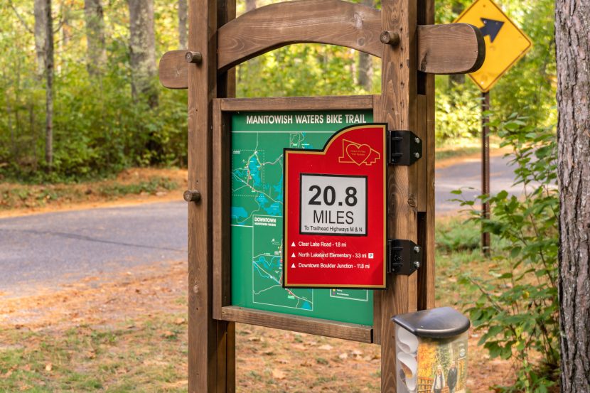
The Heart of Vilas County Paved Bike Trail System is a scenic 52-mile paved trail that connects the communities of St. Germain, Sayner, Boulder Junction and Manitowish Waters in Vilas County and Mercer in Iron County.
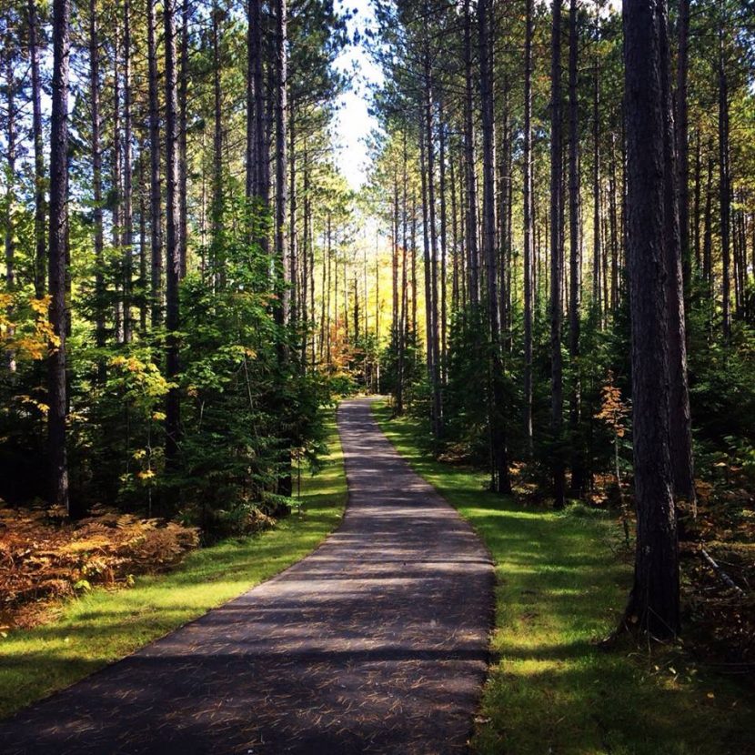
The smooth asphalt trail travels through Wisconsin’s largest state forest — the 223,000-acre Northern Highland-American Legion State Forest — giving riders a wilderness experience while offering amenities that make the journey as easy as it is rewarding.
The Heart of Vilas County Paved Bike Trail System was recently named a National Recreation Trail, an honor the Department of the Interior gives to exemplary trails of local and regional significance. Local trail advocates say the recognition is well-deserved.
“These trails are a huge draw to this area and something that is very unique to Northern Wisconsin,” Sara Pearson, northern region program manager for the Wisconsin Department of Natural Resources, said in a letter nominating the trail for the honor.
Cherie Sanderson, president of the Boulder Junction Chamber of Commerce and director of the Boulder Junction Library, said that one of the things that makes the trail special is the varied landscape it crosses, including wild forests, wetlands, prairie areas and undeveloped glacial lakes. Sanderson is a cyclist who has logged a lot of miles on the system on her hybrid bike.
“It’s simply a beautiful ride,” she said. “Every part of it offers something new and beautiful that you would not see if you were riding on the road.”
While the trail rolls through some incredible Northwoods scenery, its connection to the communities of northern Wisconsin is also part of the trail’s charm.
“Every community has a different personality, so it’s fun to ride into these small towns and meet the people who live here and work here,” Smith said.
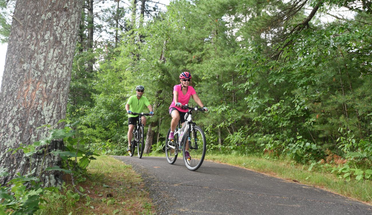
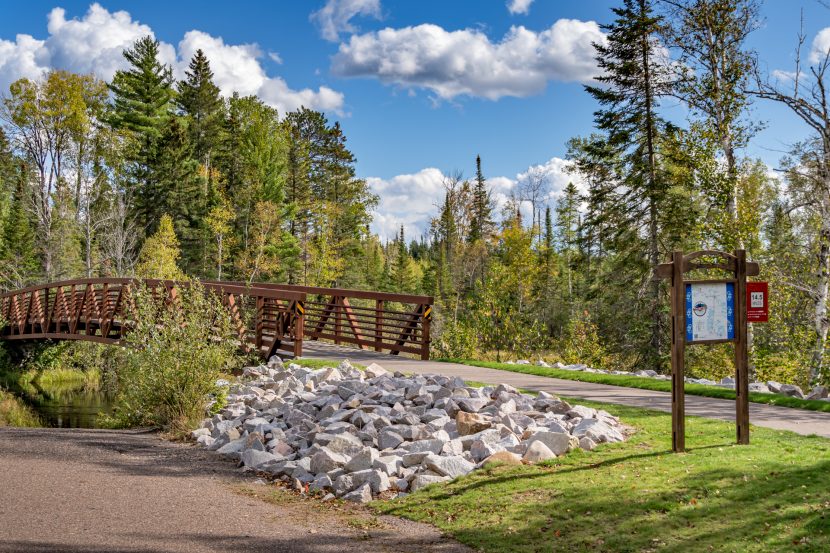
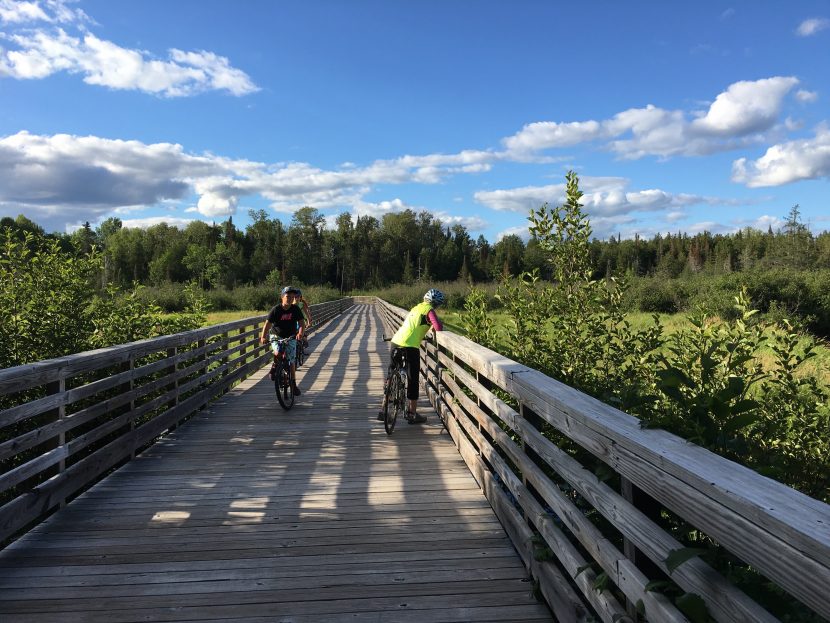
The trail takes riders through various terrain, from flat to rolling land, manageable hills and multiple scenic bridges. The segments between towns form a complete route that involves little road riding. While some cyclists opt to ride the entire route point to point, many choose to pick a shorter segment to ride. There are 20 parking areas along the trail, so it’s easy to break the trail into a series of rides. Several restrooms and bicycle repair stations are available to trail users.
RIDE DETAILS
The trail’s southern terminus is in St. Germain, a popular vacation town of about 2,000 people. There is free parking available at the trailhead on Highway 70. The trail passes St. Germain’s business district, and it’s a good place to pull off to grab some breakfast, a cup of coffee or some last-minute supplies for the ride. There is also a grocery store and lodging available along the trail.
From St. Germain, the trail heads west and north to a small community with a big history. Sayner’s claim to fame is connected to trails of a different sort — the modern snowmobile was invented in this town. You can see some early snowmobiles, including an original “motor toboggan” as well as other interesting bits of local history at the Vilas County Historical Museum. Lodging and dining is also available in Sayner.
From Sayner, the trail continues west, passing Crystal Lake about six miles from Sayner. The undeveloped lake is surrounded by state forest and is worth a stop. The lake is appropriately named — the water is perfectly clear. Soft sand beaches make Crystal Lake an inviting place to cool off on a warm summer day. There’s also a popular campground adjacent to the lake. From Crystal Lake, the trail continues west about three miles before turning north to skirt South Trout Lake and North Trout Lake. The trail passes some gorgeous lake vistas as well as a couple of good trails for a short and scenic hike.
The North Trout Nature Trail is a hiking path that meanders about a mile through the forest, crossing some scenic boardwalks. Cathedral Point is another beautiful spot worth a stop. From the trail, you can reach the point via a short ride down Cathedral Point Road. Cathedral Point is a narrow strip of land between the basins of North and South Trout Lake, studded with gorgeous 100-foot pines.
Continuing north, the trail winds into Boulder Junction. This town — surrounded by 194 glacial lakes — is also known as the Musky Capital of the World. While the town has long been a mecca for anglers, it has also become a destination for silent sports. Bike repairs and rentals are available in town, as well as lodging, dining and a grocery store. From Boulder Junction, the trail heads west, passing Nichols Lake. There’s a park with a pleasant swimming beach that makes a good rest stop.
The trail continues west to Manitowish Waters, passing some beautiful views and a pleasant pedestrian bridge. In Manitowish Waters, you’ll find a range of good lodging and dining and a well-stocked grocery store. Manitowish Waters is a popular recreation destination and is near a connecting trail that travels four miles north to the WinMan Trails, a renowned off-road trail system for mountain biking, fat biking, cross-country skiing and snowshoeing.
The Heart of Vilas continues west from Manitowish Waters to the Iron County community of Mercer. In Mercer, you’ll reach the western trailhead and more opportunity for adventure. Mercer is a good point to stage a paddling trip into the 14,300-acre Turtle Flambeau Flowage, and it’s also surrounded by more than 74,000 acres of public forestland and miles of backcountry hiking trails.
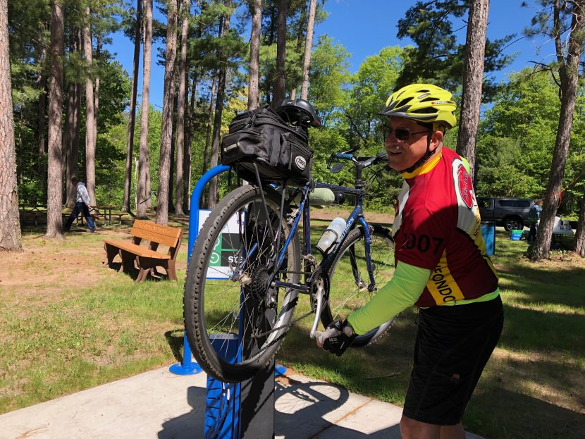
While the Heart of Vilas crosses some wild areas, amenities along the trail are plentiful. Because the trail passes through towns that serve travelers, cyclists are never far from a refueling spot to enjoy a hot coffee, refreshing beer or an ice cream cone. There are more than 20 public restrooms along the route and seven well-equipped bike repair stations. The trail is smooth and can accommodate road and touring bikes and the terrain is mostly flat with a few small hills. Sanderson said the trail is safe and relaxing and she is comfortable embarking on solo rides.
“It’s quiet and you feel like you are in nature, but you are not too far away from civilization,” she said.
Mary Van Grinsven, a member of the Northwoods Ski Touring Association (NSTA), said her group often rides the Heart of Vilas system on its weekly summer bike rides. The association was founded as a cross-country ski club but has expanded to silent sports activities throughout the year, with between 75 and 100 active members in northern Wisconsin.
Van Grinsven said her club’s rides can draw around 25 riders and the trail is ideal for the group’s outings, as it’s separated from traffic, scenic and well maintained. She said that because the trail extends more than 50 miles it’s never crowded, although the word is getting out about the Heart of Vilas trail system.
“Every year, we are seeing more and more bikes on the trail,” she said.
For GPS maps of the trail segments, you can download the free Map It Vilas County trails app on Apple and Android (more information at vilaswi.com/trails).
Theresa Smith is executive director of the Boulder Junction Chamber of Commerce. To learn more and order a free map of the Heart of Vilas, visit biketheheart.org.
More Trails to Come in Vilas County
By Jeff Currie
A new trail between Conover and Phelps will be completed this summer, and groundwork has been made for a trail that will add 10 miles (a 20% expansion) to the nationally recognized Heart of Vilas Trail System.
The paved River Trail will connect Eagle River into the Heart of Vilas System at St. Germain along the Wisconsin River. The River Trail Commission hopes to start work on River Trail in 2022.
The last section of the Conover-Phelps Trail will be completed this summer. Currently the trail starts in Conover’s Town Park and follows a railroad corridor east before it ends 1.9 miles short of Phelps. That last stretch to be built will bring the trail to Phelps’ Lakefront Pines Park on North Twin Lake.
Other new trails include Three Eagle Trail, which lets people get deep into wetlands and woodlands south of Eagle River as it makes its way 13 miles to Three Lakes. Trail users encounter three boardwalks and a bridge crossing Mud Creek, whose name belies the great views from the trail.
Land O’Lakes, at the border of Michigan’s U.P., boasts a variety of riding venues thanks to Wilderness Lakes Trails volunteers. Their 12-mile paved trail wends its way through Land O’ Lakes to the beach at Black Oak Lake. Running north to Watersmeet, Michigan, is the 14-mile Agonikak Trail, best explored by mountain bike. Those wanting to combine trail riding and road riding can make the 36-mile loop into the U.P., around the Sylvania Wilderness Area, and back to Land O’ Lakes.
Jeff Currie is executive director of the nonprofit Great Headwaters Trail based in eastern Vilas County. For more information, go to ghtrails.org.